
Back to profile
Contact person for... - dr. J (Johannes) Reiche
Pages
News
-
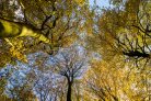
Sensitivity of Sentinel-1 Backscatter to Management-Related Disturbances in Temperate Forests
| Sensitivity of Sentinel-1 Backscatter to Management-Related Disturbances in Temperate Forests - WUR News Sensitivity of Sentinel-1 Backscatter to... -
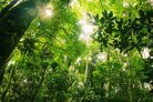
Integrating satellite-based forest disturbance alerts improves detection timeliness and confidence
| Integrating satellite-based forest disturbance alerts improves detection timeliness and confidence - WUR News Integrating satellite-based forest... -
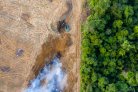
AI reveals landscape patterns after deforestation in Africa
| AI reveals landscape patterns after deforestation in Africa - WUR News AI reveals landscape patterns after deforestation in Africa... -

AI system predicts illegal deforestation: Already prevented the clearing of 30 hectares near a gold mine'
| Ontbossing is één van de grootste bedreigingen voor het klimaat en voor belangrijke woongebieden van mens en dier. Forest Foresight, het... -

World Wildlife Fund and Wageningen University cooperate in monitoring illegal logging.
| World Wildlife Fund and Wageningen University cooperate in monitoring illegal logging. - WUR News World Wildlife Fund and Wageningen University...