
Thesis subject
Measuring rainfall using cell phone links: calibration and validation using a high-resolution X-band radar
Introduction
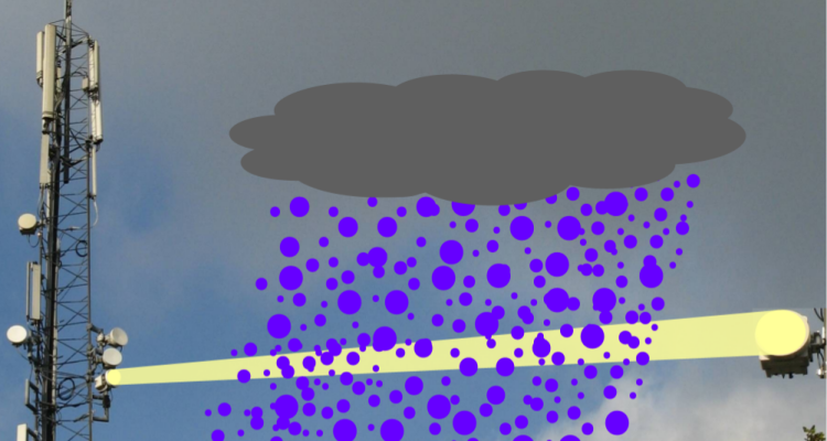
Rainfall is usually measured with rain gauges or weather radars. The estimation of rainfall using microwave links from commercial cellular telephone networks is a new source of information. Those networks cover large parts of the land surface of the earth and have a high density, especially in urban areas. The data produced by the microwave links in such networks is essentially a by-product of the communication between mobile telephones. The electromagnetic signals transmitted from one mobile telecommunication antenna to another are attenuated by rainfall. By measuring the received power at one end of a microwave link as a function of time, the path-integrated attenuation due to rainfall can be calculated. It has already been shown that from this attenuation average rainfall intensities can be derived over the length of a link (typically 0.1 - 10 km). Therefore, microwave links are potentially promising for measuring rainfall with a high temporal resolution (15 min).
High-resolution X-band radar and rainfall estimation from microwave link data
The TU Delft operates a high-resolution X-band radar at the top of the meteorological measurement tower at the Cabauw experimental site for atmospheric research in the Netherlands. This radar, called IDRA (IRCTR Drizzle Radar), measures every minute and with a high spatial resolution of 30 m up to a range of typically 15 km. The KNMI weather radars have been used to calibrate and validate a rainfall retrieval algorithm to compute rainfall intensities from microwave link data (Overeem et al., 2011). These radars measure only once in 5 minutes and have a spatial resolution of 1 km. Hence, IDRA has the potential to give more accurate rainfall information on a local scale and for short durations. It would therefore be interesting to use data from IDRA to improve rainfall estimation from microwave link data. The data from IDRA could also be used to simulate microwave link data to find optimal interpolation methods to obtain local rainfall maps.
Activities
Use IDRA data to calculate path-average rainfall intensities for a number of commercial microwave links in the vicinity of Cabauw (near Utrecht). Compare rainfall intensities from IDRA with those derived from microwave links. Use IDRA data to improve the rainfall retrieval algorithm for microwave links. Compare link-based rainfall maps to IDRA radar rainfall images. Simulate link data from IDRA data to find optimal interpolation methods to obtain local rainfall maps.
Fog detection
Another topic that could be investigated without using IDRA data is fog detection using microwave links. Some of the microwave links (about 8 per day) operate at a frequency of almost 60 GHz. These links could be useful for detection of fog, which would be relevant for monitoring of severe weather. This has probably not been investigated yet for links with this frequency, which are specifically vulnerable to attenuation due to fog. Data from automatic weather stations and satellites can be used to detect fog and can be compared to data from these microwave links.
Details
MSc thesis at Hydrology and Quantitative Water Management Group of Wageningen University (WU)
MSc thesis or internship at the Royal Netherlands Meteorological Institute (KNMI, De Bilt).
Possible supervisors:
- Aart Overeem (KNMI/WU)
- Hidde Leijnse (KNMI)
- Remko Uijlenhoet (WU)